Secondary Port information is provided in Nautical Almanacs such as Reeds’ and also in the Admiralty Tide Tables. These publications can’t possibly give complete Tide Tables for all of the hundreds of small ‘Secondary Ports’ around the coast. Instead they give complete Tide Tables for all of the larger ‘Standard Ports’ like Dover and Devonport (Plymouth). They then also provide ‘Secondary Port Differences’ so that times and heights for any Secondary Port can be easily worked out.
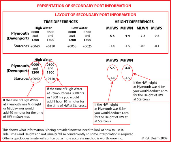
LAYOUT OF SECONDARY PORT INFORMATION
Secondary Port Time and Height Differences are always presented in a uniform and logical way. Have a look at the diagram below. The top part shows us the presentation of the information in the Almanac or the Admiralty Tide Tables. Underneath we take a look at what that information means.
Secondary port information Explained
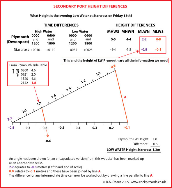
Secondary Ports - Finding the Height
This diagram will show us how we use the same process to find the Height of the evening Low Water at Starcross.
Secondary Port Tidal Height Differences
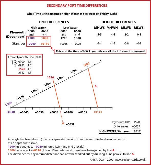
How are we going to use that information?
Look at the example here. We want to find out the time of High Water at Starcross on the afternoon of the 13th. The Standard Port is Plymouth (Devonport).
Secondary Port Time Differences
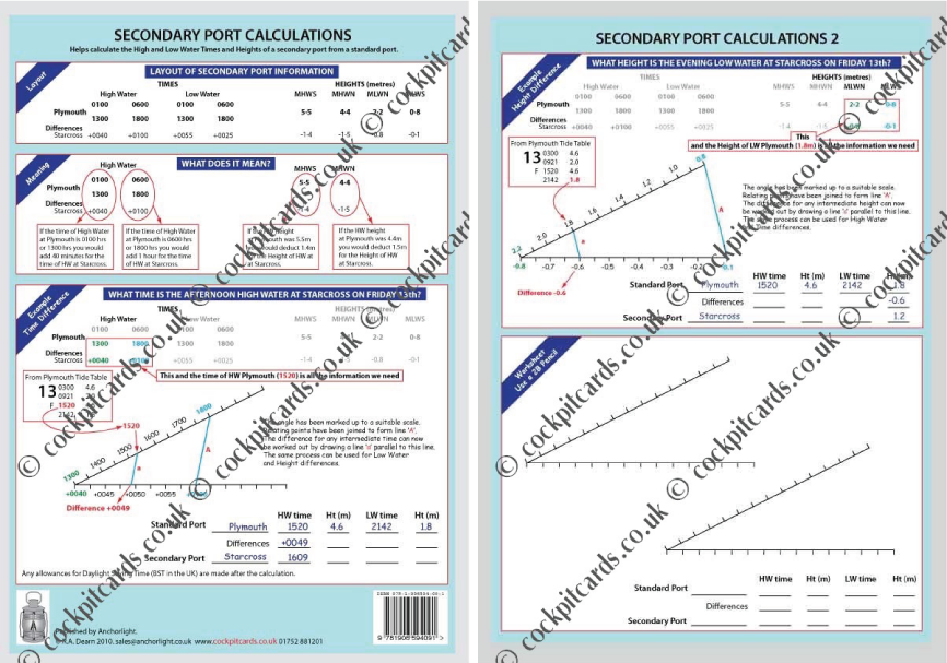
Why not splash out and buy our handy encapsulated Secondary Port Calculation Sheet. This will remind you how to do the calculations. It is A4 matt encapsulated so can be used and re-used with a 2B pencil.